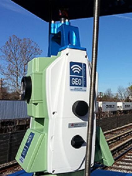
Automated motorised total stations (AMTS) are an advanced and autonomous optical monitoring system built around a high precision total station.

Common uses
Process
AMTS provide direct monitoring of deformation and settlement in structures and support systems.
Operating autonomously, they obtain frequent readings, while achieving accuracy similar to that of standard geotechnical instruments.
Data transmission and least-squares processing are both automatic, which allows web monitoring platforms such as Quickview to display updated data hourly and enable automatic reporting and alarms.
We design our own AMTS networks specific to every site, delivering a fully transparent and quality-checked service that takes any future construction into account.
AMTS monitoring requires installation of:
- Precise monitoring prisms on the structure
- Precise reference prisms outside the zone of influence
- A robotic total station with direct line of sight to all prisms.
- A datalogger unit for unattended 24/7 operation. This controls the station, transmits data, and handles power management, whether mains or solar powered.
As each site is unique, special brackets and support elements are designated for each project to fit the elements in secure and stable locations.
Automated motorised total stations (AMTS), installed at key points on a structure, accurately measure horizontal and vertical angles and the distance between a station and the monitoring points.
Adjustment and correction software then outputs the coordinates of each monitoring point. Changes in time of those coordinates correspond to the target’s movement, which can be quantified in amplitude and direction.
The latest technology is used at every stage.
Data acquisition is covered by high end total stations designed to run continuously for monitoring applications, such as TopCon MS05AXII or Leica TM50, both are rated at a high-precision angle accuracy of 0.5”.
Data processing is done through proven industry solutions using the least squares adjustments method and implemented in STARNET software.
Data quality control is ensured using our in-house software. This checks for network errors and tracks real-time data return percentages.
Advantages
- High accuracy: Our experience in networking different AMTS, installing redundant references and common points across stations, ensures quality results.
- Safety: Data and alarms are produced 24/7.
- Automation: Automation means less maintenance and cost savings.
- Reliability: Prisms have no electronics to fail and no cables that can be cut. Total stations monitor remotely, so they can be installed in secure locations, safe from accidental damage.
- Ease of installation: Easy installation and flexibility as no cables are required between monitoring points.
- Data integration: Our software can output data as specified by the customer, and combine it with other geotechnical instrumentation and CAD-generated plan views and as-builts.